


Saginaw County PUMA, Michigan
About
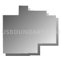
Outline

Summary
| Unique Area Identifier | 193160 |
| Name | Saginaw County PUMA |
| State | Michigan |
| Area (square miles) | 815.97 |
| Land Area (square miles) | 800.11 |
| Water Area (square miles) | 15.85 |
| % of Land Area | 98.06 |
| % of Water Area | 1.94 |
| Latitude of the Internal Point | 43.32826670 |
| Longtitude of the Internal Point | -84.05541000 |
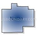
Maps


Graphs
Select a template below for downloading or customizing gragh for Saginaw County PUMA, Michigan


Neighbors
Neighoring Public Use Microdata Area (by Name) Neighboring Public Use Microdata Area on the Map
- Bay & Midland Counties PUMA, MI
- Genesee (West) & Shiawassee Counties PUMA, MI
- Isabella, Gratiot & Clare Counties PUMA, MI
- Tuscola, Sanilac & Huron Counties PUMA, MI
Top 10 Neighboring County (by Population) Neighboring County on the Map
- Genesee County, MI (425,790)
- Saginaw County, MI (200,169)
- Bay County, MI (107,771)
- Midland County, MI (83,629)
- Shiawassee County, MI (70,648)
- Tuscola County, MI (55,729)
- Gratiot County, MI (42,476)
Top 10 Neighboring County Subdivision (by Population) Neighboring County Subdivision on the Map
- Saginaw city, Saginaw County, MI (51,508)
- Midland city, Midland County, MI (41,706)
- Saginaw charter township, Saginaw County, MI (40,840)
- Vienna charter township, Genesee County, MI (13,255)
- Thomas township, Saginaw County, MI (11,985)
- Monitor charter township, Bay County, MI (10,735)
- Flushing charter township, Genesee County, MI (10,640)
- Bridgeport charter township, Saginaw County, MI (10,514)
- Tittabawassee township, Saginaw County, MI (9,726)
- Buena Vista charter township, Saginaw County, MI (8,676)
Top 10 Neighboring Place (by Population) Neighboring Place on the Map
- Saginaw city, MI (51,508)
- Midland city, MI (41,863)
- Freeland CDP, MI (6,969)
- Bridgeport CDP, MI (6,950)
- Buena Vista CDP, MI (6,816)
- Shields CDP, MI (6,587)
- Frankenmuth city, MI (4,944)
- Chesaning village, MI (2,394)
- St. Charles village, MI (2,054)
- Zilwaukee city, MI (1,658)
Top 10 Neighboring Unified School District (by Population) Neighboring Unified School District on the Map
- Bay City School District, MI (72,031)
- Saginaw City School District, MI (57,759)
- Midland Public Schools, MI (53,040)
- Saginaw Township Community Schools, MI (40,851)
- Flushing Community Schools, MI (27,111)
- Owosso Public Schools, MI (24,998)
- Clio Area School District, MI (20,392)
- Bridgeport-Spaulding Community School District, MI (12,634)
- Freeland Community School District, MI (11,914)
- Chesaning Union Schools, MI (11,533)
Top 10 Neighboring State Legislative District Lower Chamber (by Population) Neighboring State Legislative District Lower Chamber on the Map
- State House District 99, MI (101,977)
- State House District 93, MI (98,165)
- State House District 96, MI (91,648)
- State House District 85, MI (90,341)
- State House District 98, MI (89,740)
- State House District 94, MI (89,541)
- State House District 84, MI (88,847)
- State House District 48, MI (83,139)
- State House District 95, MI (72,851)
Top 10 Neighboring State Legislative District Upper Chamber (by Population) Neighboring State Legislative District Upper Chamber on the Map
- State Senate District 26, MI (275,787)
- State Senate District 22, MI (273,659)
- State Senate District 27, MI (256,301)
- State Senate District 31, MI (255,631)
- State Senate District 36, MI (254,090)
- State Senate District 32, MI (242,645)
Top 10 Neighboring 111th Congressional District (by Population) Neighboring 111th Congressional District on the Map
- Congressional District 4, MI (686,378)
- Congressional District 1, MI (650,222)
- Congressional District 5, MI (635,129)
Top 10 Neighboring Census Tract (by Population) Neighboring Census Tract on the Map
- Census Tract 101, Saginaw County, MI (9,726)
- Census Tract 103.02, Saginaw County, MI (7,695)
- Census Tract 2856, Bay County, MI (7,016)
- Census Tract 113, Saginaw County, MI (6,903)
- Census Tract 2855, Bay County, MI (6,693)
- Census Tract 110, Saginaw County, MI (6,111)
- Census Tract 107, Saginaw County, MI (6,103)
- Census Tract 131, Saginaw County, MI (6,033)
- Census Tract 301, Shiawassee County, MI (5,978)
- Census Tract 104.02, Saginaw County, MI (5,781)
Top 10 Neighboring 5-Digit ZIP Code Tabulation Area (by Population) Neighboring 5-Digit ZIP Code Tabulation Area on the Map
- 48706, MI (40,596)
- 48601, MI (38,406)
- 48602, MI (30,119)
- 48867, MI (28,264)
- 48708, MI (27,262)
- 48603, MI (26,913)
- 48433, MI (26,497)
- 48420, MI (22,078)
- 48623, MI (13,993)
- 48604, MI (13,074)